Policy S/RSC/SBR: Land South of Babraham Road, Sawston
- Site area of 12.08 hectares.
- Capacity for approximately 280 homes.
1. Development proposals must demonstrate how they will meet the following requirements:
a. A financial contribution towards expanding the capacity of the Icknield Primary School;
b. Creation of a significant landscape buffer along the eastern, southern and northern boundary of the site where it adjoins farmland to provide a soft green village edge. This should incorporate the existing vegetation on the site boundary;
c. Mitigate impacts on the nearby Sawston Hall Registered Park and Garden, by protecting and enhancing the asset and its setting; and
d. Vehicular access from Babraham Road only, but to include additional cycle and pedestrian links into Sawston along the western boundary of the site including to The Green Road, Church Lane and Plantation Road.
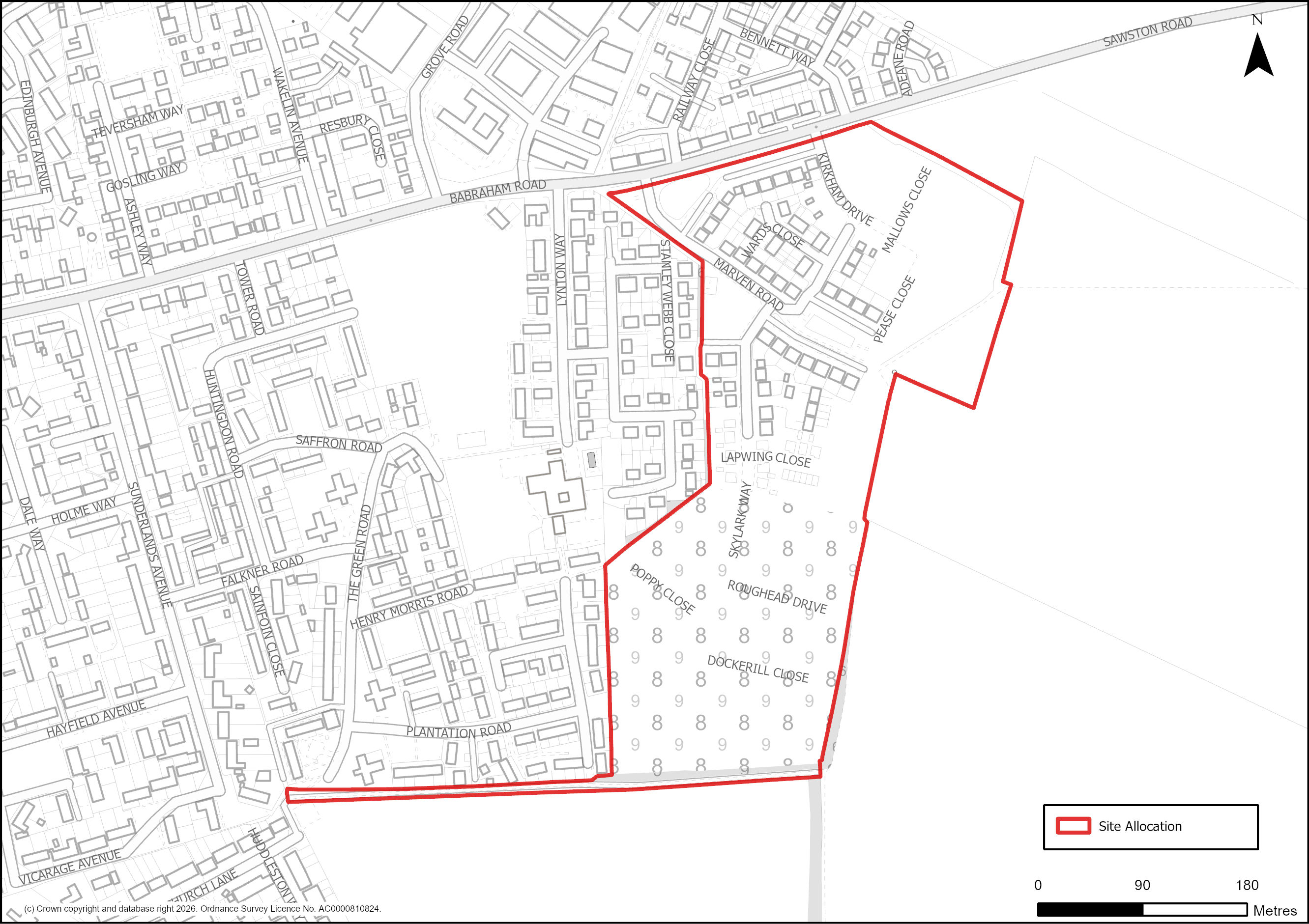
Figure 78: Site Plan of S/RSC/SBR: Land south of Babraham Road, Sawston.
Supporting information
3.4.33. This 12.08 hectare agricultural site is allocated for approximately 280 homes. The site was initially removed from the Green Belt and allocated for development in the South Cambridgeshire Local Plan 2018. It provides an opportunity for development in one of the most sustainable villages in the district. Given the edge of village location, robust landscape measures should be introduced to minimise adverse impacts on the adjacent Green Belt and landscape character. Given that Sawston is a rural centre in the settlement hierarchy with many facilities, it should minimise the need to travel by car and should therefore provide walking and cycling opportunities to encourage active travel. A financial contribution is required to ensure adequate provision for the Icknield Primary School to increase its capacity based on the anticipated population uplift.
Tell us what you think
For further guidance on how to submit comments, please see the Representation Guidance Note.
All comments must be received by 25 September 2026 at 5pm.