Policy S/RRA/SNR: Land to the north of St Neots Road, Dry Drayton
- Site area of 4.6 hectares.
- Capacity for approximately 5,000 square metres of office (Class E(g)(i)), research and development (Class E(g)(ii)), and light industrial (Class E(g)(iii)).
1. Development proposals must demonstrate how they will meet the following requirements:
- Development proposals must enhance the existing southern hedgerow to provide visual screening and include trees of forest scale and understorey planting. Landscape proposals must take into account landscape enhancements associated with the Cambourne to Cambridge high quality public transport (HQPT) corridor and East West Rail;
- Implement measures necessary to provide good public transport and active travel access to the site from surrounding existing and planned developments;
- The form and siting of the development will need to account for and safeguard land for the Cambourne to Cambridge high quality public transport (HQPT) corridor;
- Development of the site must not prejudice the preferred East-West Rail route alignment or its delivery; and
- Must be accompanied by an appropriate archaeological assessment, including the extent, character and condition of the archaeological resource and the likely impact of the development on the archaeological remains.
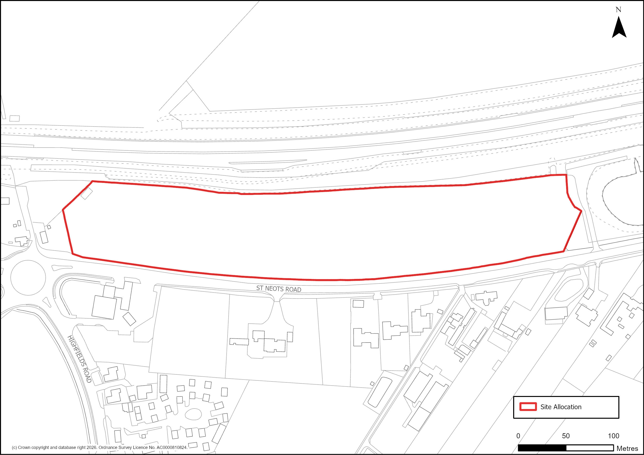
Figure 94: Site Plan of S/RRA/SNR: Land to the north of St Neots Road, Dry Drayton
Supporting information
3.5.20. This 4.6 hectare site represents an opportunity to provide approximately 5,000 square metres of appropriate employment uses adjacent to residential properties. The site will have potentially good public transport and active travel connections, meaning future users will be able to travel to and from the site using sustainable modes of transportation. Given the proposed Cambourne to Cambridge high quality public transport (HQPT) corridor, it is likely that the developable area of the site will be around 3.4 hectares to take account of land required to deliver this infrastructure project. The site is also located near to Cambourne and Bourn Airfield where significant residential development is taking place. The site will therefore potentially offer employment opportunities for prospective residents in these places and allow future users of the site to access these settlements' key services.
3.5.21. Due to the close proximity of the proposed East-West Rail route, the policy requires development proposals to account for the rail route to ensure the allocation does not impact its delivery or future operations.
3.5.22. By delivering landscaping to provide visual screening on the site, the development will potentially have a positive impact upon its surroundings. Furthermore, the development
should effectively link with the Cambourne to Cambridge high quality public transport (HQPT) corridor’s associated landscape enhancements, meaning that the site will capitalise upon a substantial pre-existing landscape strategy.
3.5.23. Completing archaeological work as part of any development proposal will potentially help to preserve any surviving historical artefacts.
Tell us what you think
For further guidance on how to submit comments, please see the Representation Guidance Note.
All comments must be received by 25 September 2026 at 5pm.