Policy S/RRA/SCS Land to the south of Cambridge Services, A14
- Site area of 24.58 hectares
- Capacity for approximately 90,000 square metres gross internal area of Class B2 (General Industrial) or Class B8 (Storage or Distribution), with around 2.25 hectares focused on lorry parking to provide around 150 spaces.
- The site should provide a range of primarily small to medium-scale units and lorry parking with associated facilities. Any storage and distribution floorspace should meet local needs.
1. Development proposals must demonstrate how they will meet the following requirements:
- Site boundaries to provide landscape buffers of a minimum of 25 metres wide to mitigate adverse landscape impacts of built form and light pollution as well as the provision of open space and tree planting through the site as part of a landscape led masterplan;
- Existing watercourses to be utilised and enhanced, with further native planting within the drainage proposals; Existing balancing ponds to be re-profiled and watercourses utilised and enhanced to address the risk of surface water flooding and for biodiversity net gain, incorporating native planting within the drainage proposals;
- Building heights must be sensitive to the local rural context, the existing vegetation should be utilised to screen the development in long-distance views;
- To undertake a Landscape and Visual Impact Appraisal to fully assess landscape impacts and identify mitigation measures where necessary, including the careful arrangement and scale, bulk and massing of built form;
- The preservation of the rural countryside character with the development integrated with local patterns of tree planting and hedgerows with existing hedges to be retained;
- The provision of proportionate and necessary services and facilities to support the provision of lorry parking and the 24-hour nature of this facility;
- The active and passive provision of rapid and trickle electric charging for e-HGVs;
- Deliver or contribute to active travel and public transport measures which support first occupation of the site, ensuring sustainable access to the site for workers and local residents by walking, wheeling, cycling and public transport, including:
- New and improved active travel infrastructure, including connections to Boxworth, Cambridge Services and the existing A14 active travel bridge;
- Bus service improvements to serve the site, including associated infrastructure enhancements and off-peak services to cover shift patterns, with connections to nearby railway stations, Cambridge, Cambourne (including the planned allocation at Cambourne North), Northstowe, St Ives and other nearby villages; and
- An on-site Mobility Hub to facilitate multi-modal interchange and provide appropriate facilities for those arriving by walking, wheeling, cycling and public transport;
- Preparation of a comprehensive transport assessment and strategy by the developer, which must be submitted with the first planning application and agreed with the Local Highways Authority, Local Planning Authority and National Highways. These must:
- Identify how the site will achieve optimal transport outcomes, including maximising site internalisation and high active and public transport mode shares;
- Demonstrate how the development can be delivered within the agreed trip budget. A definitive trip budget based on detailed evidence must be agreed with the Local Highways Authority prior to submission of the outline application. A monitor and manage approach will be taken to ensure that the development remains within the agreed trip budget for the site throughout its delivery;
- Set out safe and adequate site access arrangements from the local and Strategic Road Network, including any off-site highways mitigations and junction improvements needed;
- Identify measures which restrict HGV movements towards Boxworth and minimise the impact of HGVs on other local communities. These must be supported by a Traffic Management Plan, including a routing plan and appropriate enforcement measures;
- Demonstrate how financial contributions towards and, as appropriate, enabling any other transport measures necessary will make the development of the site acceptable in transport terms;
- Given the area’s high potential for archaeological remains, development proposals must be accompanied by an appropriate archaeological assessment which includes information on the significance of the heritage asset, including the extent, character and condition of the archaeological resource, and evidence demonstrating how the proposals, including the form and extent of development, have responded appropriately to the assessment to avoid or, as necessary, mitigate likely impacts of the development on the archaeological remains; and
Development must not preclude any construction of, or route of the Grafham Pipeline to accommodate water infrastructure for the region in consultation with Anglian Water.
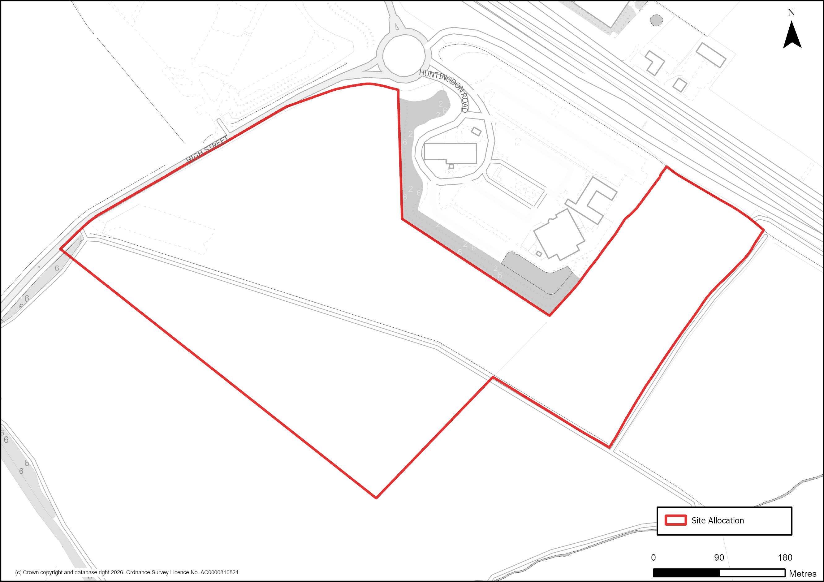
Figure 92: Site Plan of S/RRA/SCS: Land to the south of Cambridge Services, A14
Supporting information
3.5.13. This 24.58 hectare site is allocated for employment uses to meet the demand for local warehousing and logistic employment floorspace adjacent to an existing A14 Services. The policy responds to the landscape and heritage impacts identified. The required mitigation measures include undertaking a Landscape Visual Impact Appraisal and provision of additional landscaping to the boundaries of the site, and an Archaeological Assessment, required to address long distance views and ensure no unacceptable adverse impacts to landscape character and to protect the historic environment. Development is also contingent upon water management measures to be introduced for flood risk mitigation and ecology benefits.
3.5.14. The site is also allocated for 150 lorry parking spaces. This is to help address an identified need for overnight lorry parking provision in this area. The National Highways improvement works to the A14 removed a significant number of existing roadside HGV laybys which may have contributed to the recent increase in the number of HGVs using stopping spaces on local roads and near to local villages. The Department for Transport’s Future of Freight (2022) recognises the importance of supporting the freight industry including through high standard roadside facilities on the strategic road network and this allocation seeks to positively respond to this need.
3.5.15. By 2040, all new heavy goods vehicles (HGVs) will be zero emission and therefore the policy requires active and future provision for a range of electric HGV charging options to be incorporated into the infrastructure and layout of future proposals. The site has capacity for approximately 90,000 square metres of Class B2 (General Industrial) or Class B8 (Storage or Distribution).
3.5.16. This site is near to the Uttons Drove Water Recycling Centre. An odour assessment may be required. Please refer to the Cambridgeshire and Peterborough Minerals and Waste Local Plan (2021) for further information.
3.5.17. Monitoring will ensure full accountability and if necessary further mitigation, or refocused mitigation which may be needed to ensure that overall compliance with the trip budget is achieved. The full detail of these mechanisms will be established in the S106 obligations entered into on the grant of outline consent.
Tell us what you think
For further guidance on how to submit comments, please see the Representation Guidance Note.
All comments must be received by 25 September 2026 at 5pm.