Policy S/AMC/SCL: South of Coldham’s Lane Area of Major Change
1. Development proposals within the Land South of Coldham’s Lane allocation, as identified on the Policies Map, will be supported where they deliver a comprehensively planned, mixed-use development integrated with strategic green infrastructure, biodiversity enhancement and sustainable transport infrastructure, including facilitating the delivery of the new Cambridge East railway station.
2. Development will be supported, divided into four development parcels as follows if they:
Area 1 – Employment and Commercial Uses
a. Create a high-quality employment-led development capable of supporting a range of employment, R&D, and complementary ancillary uses, together with appropriate servicing, car parking and cycle parking provision;
Area 2 – Ecological Enhancement and Recreation (including the Burnside Country Park)
b. Deliver ecological enhancement and recreational provision, including the creation of Open Mosaic Habitat, or equivalent habitat appropriate to site conditions, contributing to significant Biodiversity Net Gain and the objectives of the Local Nature Recovery Strategy;
c. Safeguard land for the long-term provision of a pedestrian and cycle connection between Coldham’s Lane and The Tins Path;
Area 3 – Residential-led Mixed-use Development and Green Infrastructure
d. Deliver a residential-led mixed-use neighbourhood integrated with a multifunctional green infrastructure network that:
i. Reinforces and extends the green and blue corridor linking Coldham’s Common, the lakes, Cherry Hinton Brook and wider ecological assets;
ii. Enhances biodiversity, ecological connectivity and wildlife corridor functions;
iii. Incorporates publicly accessible open space, sustainable drainage, landscape enhancements and informal recreation;
iv. Provides high quality walking, wheeling and cycling connections within the site and to surrounding neighbourhoods; and
v. Responds positively to the setting and ecological function of Cherry Hinton Brook and adjacent habitats;
Area 4 – Cambridge East Station
e. Support and facilitate the delivery of Cambridge East railway station and associated interchange infrastructure as part of a higher-density, residential-led mixed-use district focused on sustainable movement, public transport accessibility and local services and facilities;
Comprehensive masterplanning and infrastructure delivery
3. Development proposals must be supported by a comprehensive masterplan for the allocation to be approved by the Local Planning Authority. The masterplan must demonstrate:
- The disposition of land uses, development parcels and supporting infrastructure;
- The amount and distribution of development;
- The approach to movement, connectivity and accessibility including public access and safety;
- The integration of green infrastructure, biodiversity enhancement and public open space;
- The delivery of sustainable drainage, flood mitigation and environmental mitigation measures;
- The relationship between built form, landscape character and surrounding heritage assets;
- The delivery and long-term management arrangements for public realm, ecological assets and green infrastructure; and
- Phasing and delivery arrangements, including how development would support and integrate with Cambridge East railway station.
4. Development proposals must:
- Protect and enhance existing ecological assets, wildlife corridors and Protected Open Space, having regard to the Cambridge Nature Network and Local Nature Recovery Strategy;
- Be appropriate in scale, height, massing and design to the surrounding context, including nearby residential areas, heritage assets and strategic views, including Strategic Viewpoint F (Little Trees Hill, Magog Down);
- Demonstrate that heritage impacts have been appropriately assessed and mitigated through a Heritage Impact Assessment. A Heritage Impact Assessment must be prepared for each planning application; and
- Respond appropriately to site constraints including contamination, former landfill conditions, surface water drainage, groundwater, chalk stream environments, existing lakes, and operational and safeguarding requirements associated with Cambridge Airport and the contaminated condition of the closed landfill sites, Cambridge Airport to the north, related height and use restrictions within the Air Safety Zone and Air Safeguarding Zones, the existing lakes and the chalk streams.
5. Development proposals within or adjoining the Country Park shall demonstrate that appropriate water safety measures have been considered where public access is provided in proximity to open water. Measures should be proportionate to the level of risk and should not detract from the park's recreational, landscape or ecological value and:
- Safeguard and facilitate active travel connections to the wider Cambridge East area and support infrastructure improvements associated with the Cambridge to Newmarket railway corridor, including potential future double tracking; and
- Provide direct, safe and legible walking, wheeling, cycling and public transport connections between development parcels, surrounding communities, local centres including Cherry Hinton, Coleridge and Romsey and Cambridge East railway station.
Cambridge East railway station
6. Masterplanning and development proposals must support the delivery of Cambridge East:
- Not prejudicing the delivery, operation or accessibility of the station or associated rail infrastructure;
- Establishing a pattern of land uses, movement and development density that supports public transport use and transit-oriented development principles;
- Concentrating higher density mixed-use development in the most accessible locations close to the station;
- Integrating local centres, mobility hubs and public transport interchange facilities with the station environment; and
- Ensuring early phases of development are capable of successful operation prior to station delivery whilst safeguarding future integration with rail services.
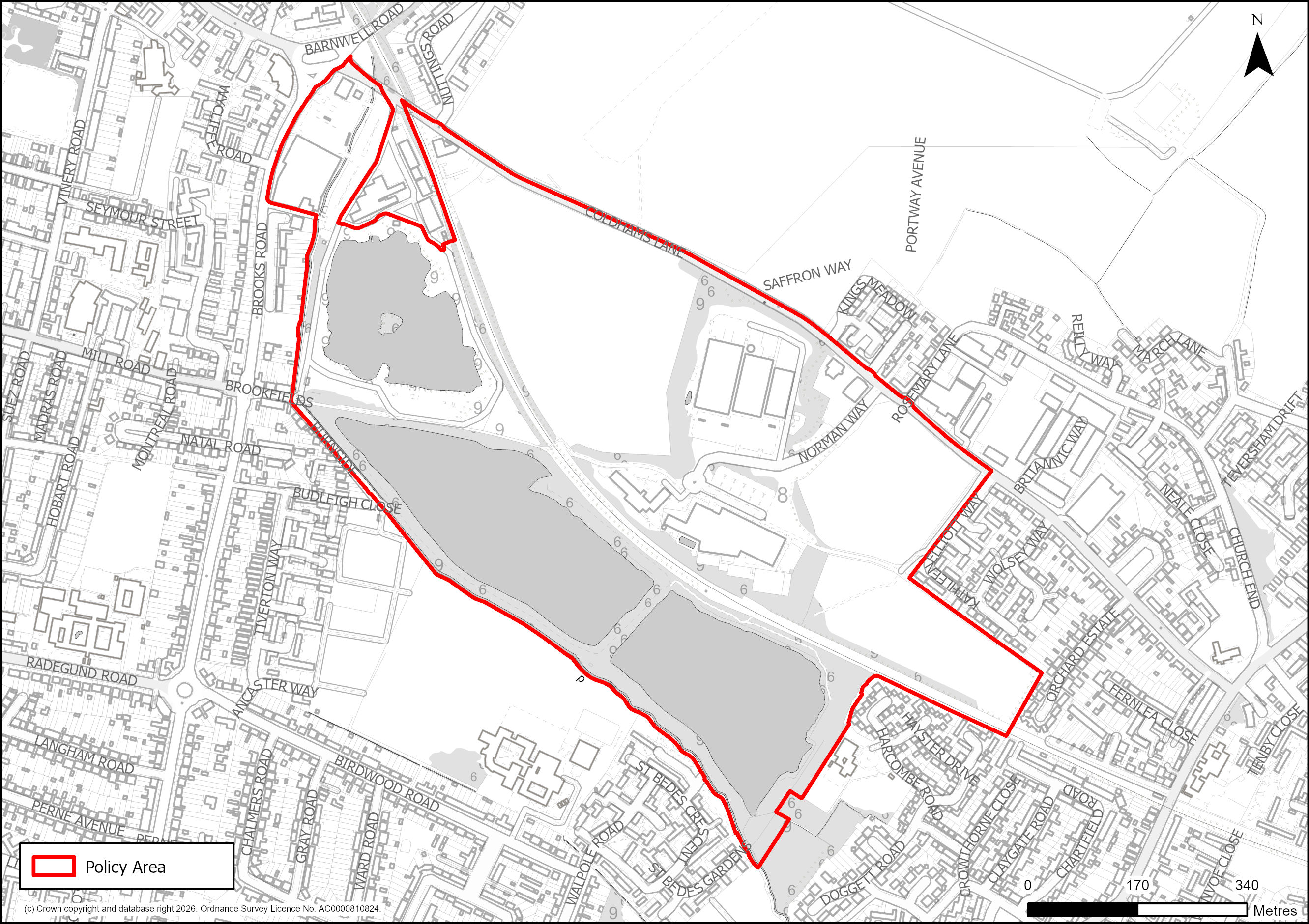
Figure 43: Site Plan of S/AMC/SCL: South of Coldham’s Lane Area of Major Change
Supporting information
3.1.117. This area can positively contribute to the character of the surrounding area and transform an enclosed space into a publicly accessible urban country park. This can be delivered by enabling a proportion of the site to be used for commercial uses whilst requiring a comprehensive masterplan to be delivered for the wider site. Uses would need to be appropriate to the land conditions and demonstrate land contamination can be mitigated appropriate to the proposed uses.
3.1.118. The redevelopment of the land south of Coldham’s Lane as an urban country park will help enhance the existing ‘green and blue corridor’ of important open spaces that runs from Coldham’s Common through the two closed landfill sites and the lakes into Cherry Hinton Hall, and then further south through to Limekiln Hill Local Nature Reserve and the Cherry Hinton Pit Site of Special Scientific Interest (SSSI). The protected open space in this policy area plays a key role as a wildlife corridor, as identified in the Cambridge Nature Network, and much of this land is identified for habitat enhancement / creation within the Local Nature Recovery Strategy (LNRS). The LNRS identifies protected habitat and should be used to inform development and biological enhancements in this area.
3.1.119. It is also important that any development proposals safeguard an active travel route leading to Cambridge East and supports any relevant proposals to allow the double tracking of the Cambridge to Newmarket railway line.
3.1.120. Outline planning permission was granted in January 2025 for offices, research and development, along with delivery of a country park This policy provides the context for any future applications in the area.
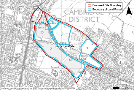
Figure 44: Diagram to show the 4 parcels of S/AMC/SCL
Tell us what you think
For further guidance on how to submit comments, please see the Representation Guidance Note.
All comments must be received by 25 September 2026 at 5pm.