Policy S/EOC/NWO: Land North of Worts’ Causeway
- Site area of 7.84 hectares
- Capacity for approximately 200 homes (delivering all homes within the plan period)
1. Development proposals must demonstrate how they will meet the
following requirements:
- The implementation of design-based mitigation, primarily in the form of building height, style, and materials, to limit impacts on the setting of designated assets, adjoining housing and Strategic Viewpoints F Little Trees Hill / Magog, E Limekiln Road, and J Worts’ Causeway / Shelford Road. A sensitive approach to internal street layout and design will integrate the development into this setting on the edge of the Cambridge Green Belt;
- Building heights should not exceed two residential storeys;
- A landscape-led design that will deliver at least a 6-metre buffer with adjoining existing housing and 30-metre buffer with the Cambridge Green Belt and retain the country lane appearance and character of Worts’ Causeway, including its verges, hedgerows and bridleway. Landscape mitigation should form part of the Green Infrastructure network for the site;
- A positive approach to biodiversity which includes the retention of sufficient buffer areas around the Netherhall Farm Meadow County Wildlife Site, supported by the provision of a long-term management regime, and the assessment of the wider site for potential to create an ecological corridor between this site and the Land South of Worts’ Causeway site. This approach should also include the retention of, or safe relocation of, existing bat roosts at Netherhall Farm;
- Active travel will be supported by the establishment of appropriate public footpaths linking the development with the surrounding chalk farmland and the retention of Worts’ Causeway’s use for buses only during peak periods with limited car access, to provide a green link into the Cambridge Green Belt with space for pedestrians, horse riders and cyclists. Car traffic will be further managed through the provision of a single point of crossover between the site Land North of Worts’ Causeway and Land South of Worts’ Causeway and a single access onto Babraham Road;
- Archaeological mitigation will be required, with archaeological remains preserved in situ, particularly as the site abuts the Roman road Worts’ Causeway and there is evidence of land undisturbed by modern ploughing present within the site; and
- Protect and enhance heritage assets and their setting including during the construction phase of the development, including the Grade II listed Milestone and the Netherhall Farm Building of Local Interest.
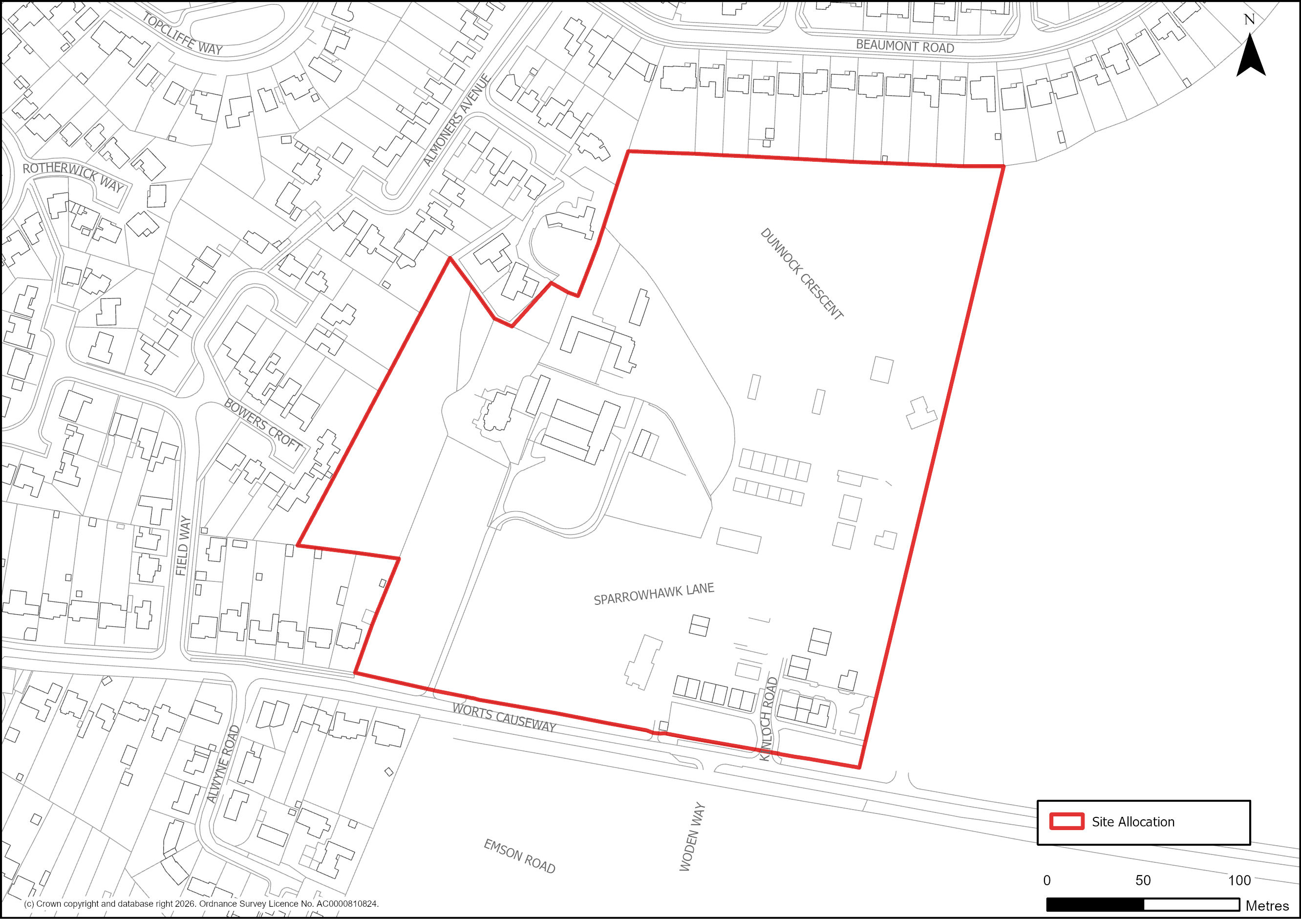
Figure 59: Site Plan of S/EOC/NWO: Land north of Worts’ Causeway
Supporting information
3.2.65. This 7.84 hectare site is allocated for approximately 200 homes, which responds to the landscape and heritage impacts identified in the Heritage Impact Assessment. The proposed landscape and design-based mitigation measures are required to ensure no unacceptable adverse impacts to landscape character and the historic environment, including the setting of designated and non-designated assets. A suitable landscape buffer is required to preserve the rural character of designated assets. The development needs to both integrate with the adjoining existing housing and provide an appropriate new edge to the Cambridge Green Belt.
3.2.66. In addition to being a Building of Local Interest, Netherall Farm is also an established bat roost. Development proposals should ideally retain the existing bat roosts but if this is not possible they must be re-located. The adjacent Netherall Hall Farm County Wildlife Site makes an important contribution to the biodiversity of the wider site and a long-term management plan will be required to maximise this contribution. However, the plan should also look at the opportunities to achieve more gains along the corridor between Land North of Worts’ Causeway and Land South of Worts’ Causeway through the retention of a country lane appearance which should be part of any landscaping proposals.
3.2.67. Encouraging active transport will help to facilitate access to the countryside and adjacent communities, whilst car use will need to be managed to reduce the urbanising impact on this edge of Green Belt site. The site has planning permission for up to 200 homes (20/01972/OUT) and is currently under construction.
Tell us what you think
For further guidance on how to submit comments, please see the Representation Guidance Note.
All comments must be received by 25 September 2026 at 5pm.