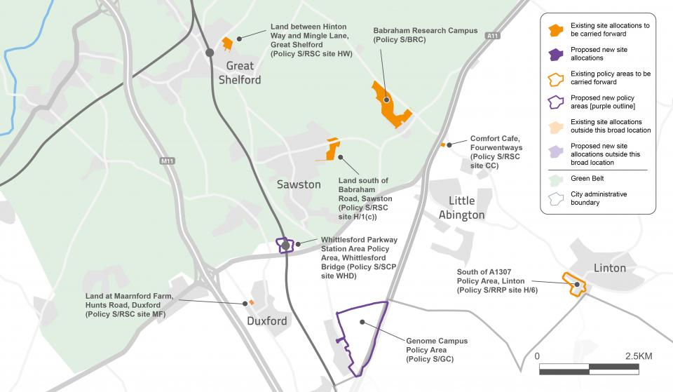
The south of Cambridge, between the M11 and the A1307, is home to a range of major business parks with world-leading facilities, and has some excellent and improving public transport links. We want to support this business cluster through ensuring that more business space is provided where needed, and through a limited amount of new housing in and around villages that are well-connected to jobs by public transport, cycling and walking facilities. We believe that a case can be made for exceptional circumstances to release some limited areas of Green Belt land here, as new development in this location will generate less carbon emissions from car use.
How have the plan’s themes influenced this?
The rural southern cluster provides an opportunity to locate homes near jobs, and support the development of the important employment sites in this area. There are also existing and planned public transport opportunities to access Cambridge, helping to minimise traffic and related carbon emissions. This option most closely connects to Strategic Green Infrastructure Initiative 3: Gog Magog Hills and Chalkland Fringe.
Topic paper
Further information on the policy areas, including their national, regional and local context, and further information on the evidence that has informed the proposed policy direction, can be found in the topic paper which accompanies this theme:
- Greater Cambridge Local Plan: Topic paper 1: Strategy
Tell us what you think
Our consultation for this phase is now closed.