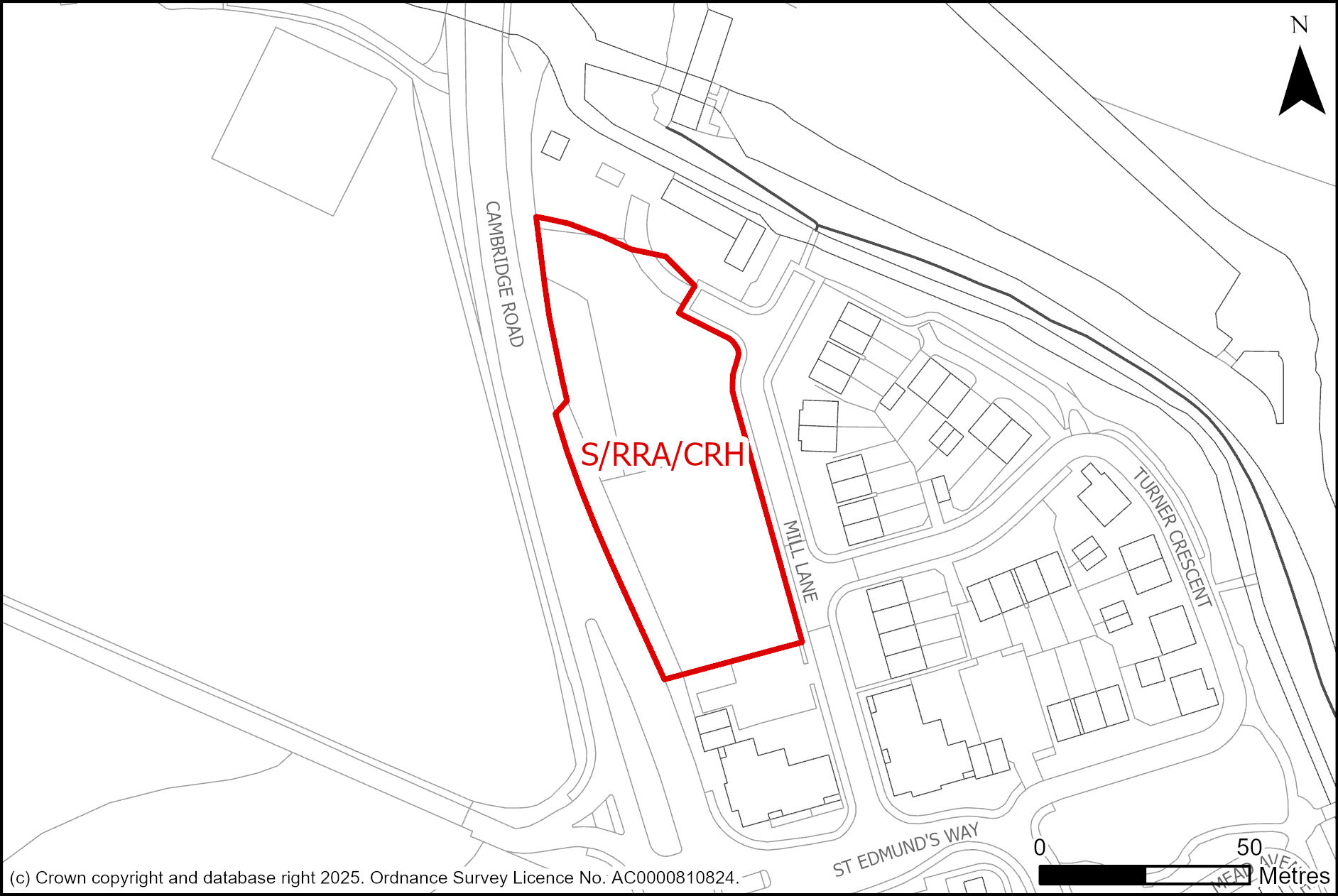
- Site area of 0.40 hectares
- Capacity for 2,000 square metres gross internal area of office (Class E(g)(i)), research and development (Class E(g)(ii)), and light industrial (Class E(g)(iii)) floorspace.
1. Development proposals must demonstrate how they will meet the following requirements:
a. Development at a scale and grain to make a positive contribution to local townscape character;
b. Siting, height, and design of buildings should respond positively to the local character and setting, ensuring no unacceptable adverse visual impact on the openness of Cambridge’s Green Belt or on the wider setting of nearby heritage assets – the Grade II listed Old Mill House, two Grade II listed buildings associated with Hauxton Watermill, and Grade II listed Milestone on Hauxton Mill Bridge;
c. Development proposals should deliver a planted landscape edge, including trees, along the northern and western edges of the site, as part of a landscape-led approach. Hedges should be maintained at no more than 1.8 metres; and
d. Development proposals must be accompanied by an appropriate archaeological assessment, including the extent, character and condition of the archaeological resource and the likely impact of the development on the archaeological remains.
Supporting information
This 0.4 hectare site is allocated for approximately 2,000 square metres of employment space. A mixed-use scheme on the former Bayer CropScience site originally obtained planning permission in 2006 (S/2308/06/O) and was allocated as part of the 2018 Local Plan. This permission has now lapsed. Much of this site’s residential and specialist accommodation for elderly people has now been completed. The original planning permission has now lapsed, but the new Local Plan seeks to retain the original vision of the site by continuing to allocate an area within the brownfield site for employment uses. The development can potentially provide an important contribution to the local economy. By turning a currently vacant brownfield site into new employment offices, the site can potentially have a positive impact upon the public realm.
A context led approach to development and its landscaping will ensure that designated nearby heritage assets- the Grade II listed building the Old Mill House, two Grade II listed watermills and the Grade II listed Milestone on Hauxton Mill Bridge- and their setting are protected and enhanced. Height should be determined using the surrounding context to ensure that it positively contributes to the wider setting of the area. This approach will also ensure that any negative visual impact upon Cambridge’s Green Belt is mitigated. Avoiding development in the north-eastern part of the site, which in flood zone 2, will ensure that future users of the site will be able to safely use the site. Completing archaeological work as part of any development proposal will also potentially help to preserve historical artefacts that could explain how people in the past used this site.
Tell us what you think
We will consider all comments while developing the next version of the Local Plan.
All comments must be received by 30 January 2026 at 5pm.